East Carroll Parish, LA/Lake Providence, LA Cemeteries
Initially posted on September 16, 2010.
Information updated as of April 25, 2015.
In an attempt to account for all the cemeteries in the parish, we have assembled a working list from a number of sources online. Names, approximate addresses, latitude and longitude, tax assessment information, and location information were retrieved from the following:
- Louisiana State Cemetery Board website (Database search)
- Louisiana Tax Commission, East Carroll Parish Tax Rolls (Legal land descriptions searched for cemeteries)
- United States Geological Survey, Geographical Names Information System
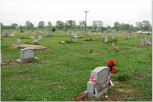
(All entries were made June 4, 1980) - FindAGrave.Com
- Transcriptions from Sandy Guthrie Moore (Personal Website), Carolyn Avery (USGenWeb Archive)
- East Carroll Parish, LA Cemetery Transcriptions from the East Carroll Parish, LA Clerk of Court - 1800s to July 1998

King Solomon Cemetery #2, in the present day location of Shelburn and
Bellemead Plantations; East Carroll Parish, LA.
Courtesy of AtlasFamily.Org Genealogy Research
Bellemead Plantations; East Carroll Parish, LA.
Courtesy of AtlasFamily.Org Genealogy Research
Alsatia Cemetery
Sources: East Carroll Parish ClerkLatitude and Longitude, Location: Undetermined
Buckmeadow Cemetery
Sources: East Carroll Parish ClerkLocation: State Highway 2, Westbound near the intersection of Highway 65
Benjamin Cemetery
Sources: USGS GNIS, FindAGraveGoogle Maps
FindAGraveRecords
Cain Ridge #1 Missionary Baptist Church Cemetery
Source: Louisiana Cemetery Board, East Carroll Parish Clerk4209 Hwy. 596, Lake Providence, LA 71254, 318-559-9074
Google Maps
China Grove Missionary Baptist Church Cemetery
Source: Louisiana Cemetery Board, East Carroll Parish Clerk810 White Road, Lake Providence, LA 71254 , 318-559-8871
Google Maps
Cold Tar/Homestead Cemetery
Source: USGS GNIS, East Carroll Parish ClerkLatitude and Longitude: 32.7001331, -91.1659423
Evergreen Baptist Church Cemetery
Sources: Louisiana Cemetery Board, FindAGrave, East Carroll Parish ClerkHighway 65, Lake Providence, LA 71254 , 318-559-0128
**Note: Has some of the oldest African American burials in the area. Records for burials before the 1990s without headstones are impossible to trace via the cemetery as record keeping was not done in an appropriate fashion. Records for burials with headstones available by contacting the cemetery. Additional records up to July 1998 available by lookup. See East Carroll Parish, LA Clerk Transcriptions link for info.*
Google Maps
FindAGrave Records
Forrest Cemetery
Source: FindAGraveUnknown Location, Monticello
FindAGrave Records
Gailliard Cemetery
Source: USGS GNIS, Louisiana Cemetery Board, East Carroll Parish Clerk, FindAGraveGoogle Maps
FindAGrave Records
Gaither Memorial Cemetery (East Carroll Baptist Association)
Source: Louisiana Cemetery Board, East Carroll Parish Clerk, FindAGraveGould Street, Lake Providence, LA 71254 , 318-559-5517
Google Maps
FindAGrave Records
Gaither Memorial (East Carroll Baptist Association) Cemetery
Courtesy of AtlasFamily.Org Genealogy Research
Good Samaritan Cemetery
Source: Louisiana Cemetery Board, Louisiana Tax Commission, East Carroll Parish ClerkArlington Street , Lake Providence, LA 71254 , 318-559-2901
2009 Parish Tax Assessment: Assessment # 4310012200, land noted as being Arlington Street, Fauxburg-Arlington, "5 acres: a tract of land beg[inning] at SW [southwest] corner of lot 1 of blk [block] 1, Arlington ADD [addition]. Used for colored cemetery."
Google Maps
Gus Sammons Memorial Cemetery
Source: Louisiana Tax CommissionTownship 19 North, Range 11 East, Section 28
3410 Highway 877, Lake Providence, LA 71254
Heavenly Rest Memorial Park
Source: Louisiana Cemetery Board, FindAGrave, East Carroll Parish ClerkGoogle Maps
FindAGrave Record
Henderson Community Cemetery/Union Baptist Church #2
Source: Louisiana Cemetery Board, Louisiana Tax Commission, East Carroll Parish ClerkHenderson Road, Henderson, LA 70517, 318-552-7751
2009 Parish Tax Assessment: Assessment # 4100002700. "CEMETERY SITE: 3.191 ACRES IN NW1/4 OF SEC. 42, T18N R13E. [Section 42, Township 18 North, Range 13 East]"
Google Maps
**Note: As of September 2, 2010 East Carroll Banner Democrat, bottom of page 6, possible name of the church is Union Baptist Church #2. Google Maps result states Union Baptist Church.**
Herringville Cemetery
Source: FindAGrave, East Carroll Parish Clerk944 Highway 577, Lake Providence, LA 71254, (318) 552-6530
FindAGrave Record
Jerusalem Cemetery
Source: USGS GNISGoogle Maps
Kerr Family Burial Ground
Source: FindAGraveUnknown Location
FindAGrave Record
King Solomon Baptist Church Cemetery #1
Source: Louisiana Cemetery Board, East Carroll Parish Clerk4932 Hwy. 65 South , Lake Providence, LA 71254, 318-559-9038
Google Maps
King Solomon Baptist Church Cemetery #2
Source: USGS GNIS, East Carroll Parish ClerkParish Road 5588, Lake Providence, LA 71254
Google Maps
FindAGrave Records
Lake Providence Cemetery
Source: FindAGrave, East Carroll Parish Clerk1354 Lake Street, Lake Providence, LA 71254
Google Maps
FindAGrave Records
Transcription from Sandy Guthrie Moore
Live Oak Cemetery
Source: East Carroll Parish ClerkUnknown Exact Location
Lone Star Cemetery /Edgewood Plantation Cemetery
Source: USGS GNIS, FindAGrave, East Carroll Parish Clerk, Louisiana Tax CommissionLocation also known as Edgewood Plantation: 2009 Parish Tax Assessment #4300008000, Description: A PARCEL OF LAND 159.14 X 245.7 FT IN E1/2 OF EDGEWOOD PLTN [Edgewood Plantation], SEC. 32, T21N R12E [Section 32, Township 21 North, Range 12 East) CONTAIN 0.898 ACRES FOR CEMETERY.
Google Maps
FindAGrave Records
Melbourne Cemetery
Source: East Carroll Parish ClerkLatitude and Longitude, Location: Undetermined
Memorial Park of Lake Providence
Sources: Louisiana Cemetery Board, USGS GNISHwy. 597 , Lake Providence, LA 71254, 318-574-0302
Google Maps
Morning Star Missionary Baptist Church Cemetery
Source: Louisiana Cemetery Board, East Carroll Parish ClerkBear Wallow Road , Lake Providence, LA 71254 , 318-559-0114
Google Maps
Mound Cemetery
Source: East Carroll Parish ClerkNear Highway 581, Lake Providence, LA (Transylvania)
Mount Pleasant Cemetery
Source: East Carroll Parish ClerkUnknown Exact Location , in the Milliken area
Mount Wade Baptist Church Cemetery
Source: FindAGrave, East Carroll Parish ClerkUnknown Location , Monticello
FindAGrave Records
Nash Plantation Cemetery
Source: Louisiana Tax Commission2009 Parish Tax Assessment # 4600001400, Description: 2 ACRES: A PARCEL OF LAND 210 x 420 FT ON THE NASH PLTN. [Nash Plantation] IN LOT 5 OF SEC. 25, T20N R11E [Section 25, Township 20 North, Range 11 East] (CEMETERY).
Google Maps
New Hope Baptist Church Cemetery
Source: FindAGrave, East Carroll Parish ClerkUnknown Location, Monticello
FindAGrave Records
New Light Cemetery
Source: East Carroll Parish ClerkUnknown Exact Location, Highway 134, 10 miles southwest of Lake Providence
New Saint Paul Baptist Church Cemetery
Source: FindAGrave, East Carroll Parish ClerkHighway 596, Lake Providence, LA
FindAGrave Records (Incorrectly labeled as Old Saint Paul)
New Vines Missionary Baptist Church
Source: USGenWeb, East Carroll Parish ClerkHighway 65 South, Sondheimer, LA
Transcription from Carolyn Avery
New Zion Missionary Baptist Church
Source: Louisiana Cemetery BoardHwy. 65 , Sondheimer, LA 71276 , 318-574-2857
FindAGrave Records
Oakland Plantation
Source: FindAGraveUnknown Location
FindAGrave Records
Old Saint Paul Cemetery
Source: USGS GNISLatitude and Longitude: Google Maps
Old Sweet Canaan Cemetery
Source: USGS GNISGoogle Maps
FindAGrave Record
Omega Cemetery
Source: East Carroll Parish ClerkUnknown Exact Location
Panola Cemetery (Brown's Farm Cemetery)
Source: USGS GNIS , FindAGrave, East Carroll Parish ClerkGoogle Maps
FindAGrave Records
Additional Research by AtlasFamily.Org Blog
Rose Hill Cemetery
Source: East Carroll Parish ClerkUnknown Exact Location
St. John Baptist Cemetery
Source: Louisiana Cemetery Board, Louisiana Tax Commission, East Carroll Parish ClerkHollybrook Road, Lake Providence, LA 71254, 318-559-4002
2009 Parish Tax Assessment: Assessment # 4200004400. 2 ACRES: A PARCEL OF LAND 3.80 X 5.00 X 3.91 X 6.00 CHNS SITUATED IN NE CORNER OF NW1/4 OF SEC. 11, T20N R12E BEING CEMETERY LOT. [Northwest 1/4 of Section 11, Township 20 North, Range 12 East]
**Note: As per September 2, 2010 issue of the East Carroll Banner Democrat, bottom of page 6, St. John Baptist Church is located on Bear Wallow Road. Only the cemetery may be located at the Hollybrook address**
Saint Mary’s Baptist Church Cemetery
Source: East Carroll Parish ClerkGoogle Maps
Stamboul Cemetery
Source: East Carroll Parish ClerkUnknown Exact Location, Transylvania
Sweet Canaan Cemetery
Source: Louisiana Cemetery BoardHighway 65 South , Lake Providence, LA 71254 , 318-559-1656
Transylvania Baptist Cemetery
Source: East Carroll Parish ClerkUnknown Exact Location, Transylvania
Travis Family Cemetery
Source: Louisiana Cemetery Board242 Travis Road, Lake Providence, LA 71254 , 318-559-5605
Google Maps
Tyrone Cemetery
Source: USGS GNIS, FindAGraveLatitude and Longitude: 32.8520729, -91.1762204
FindAGraveRecords
Waddell Cemetery
Source: East Carroll Parish ClerkUnknown Exact Location, Highway 134, 8 miles from Lake Providence
Way-a-Way Cemetery /Way Way Cemetery
Source: Louisiana Cemetery Board, USGS GNIS, FindAGrave, East Carroll Parish ClerkWay-a-Way Plantation Road, Lake Providence, LA 71254 , 318-559-2587
Google Maps
FindAGrave Records
Wilton Cemetery
Source: East Carroll Parish ClerkUnknown Exact Location
(c) AtlasFamily.Org Genealogy Research. All rights reserved.


Comments